 |
|||||
|
Brevard County, Florida : A Short History to 1955 |
|||||
Alvera Mexia Map of 1605 Indian River Lagoon |
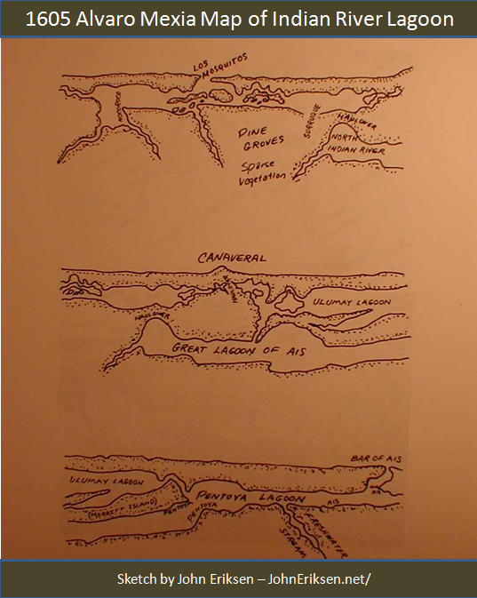 Alvera Mexia Map of 1605 Indian River Lagoon |
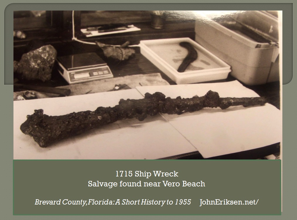 Long gun from site of 1715 Spanish Ship Wreck near McLarty Museum, Vero Beach |
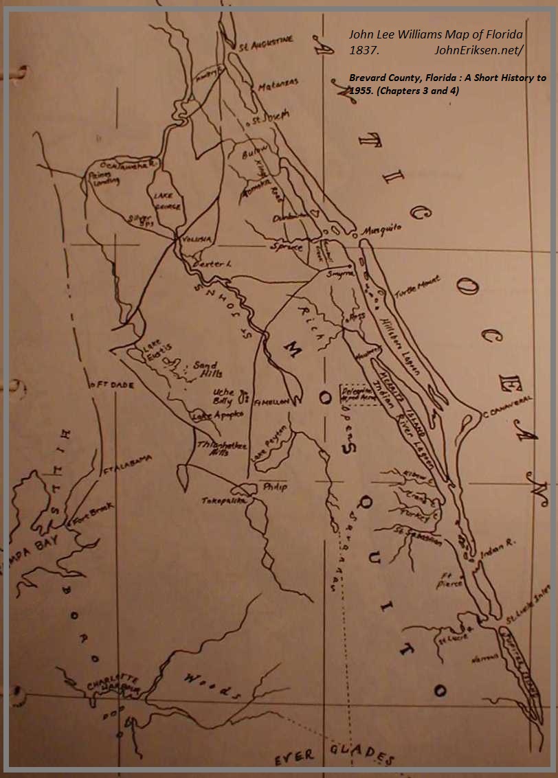 John Lee Williams 1837 Map of Florida |
 Chief Osceola circa 1835 |
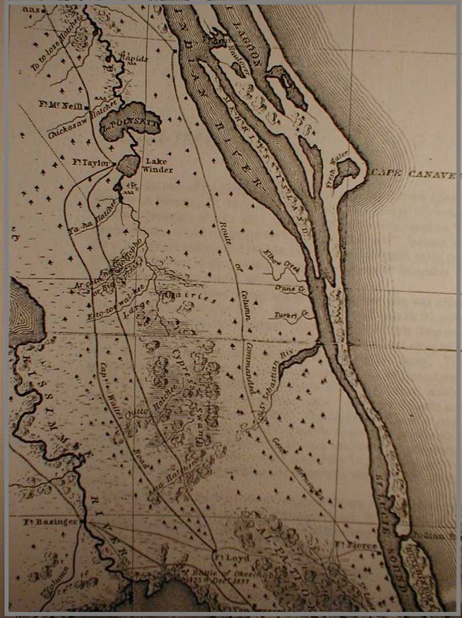 U.S. Army Map of Seminole War Roads in Florida - circa 1840 |
 Drake's Golden Hind |
 1844 Plat of Future Rockledge |
 Col. Henry Titus, Book |
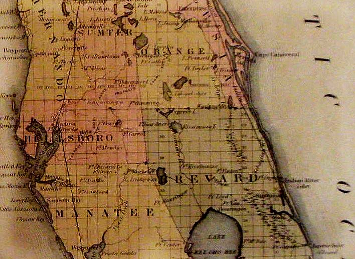 1855 Colton Map of Florida |
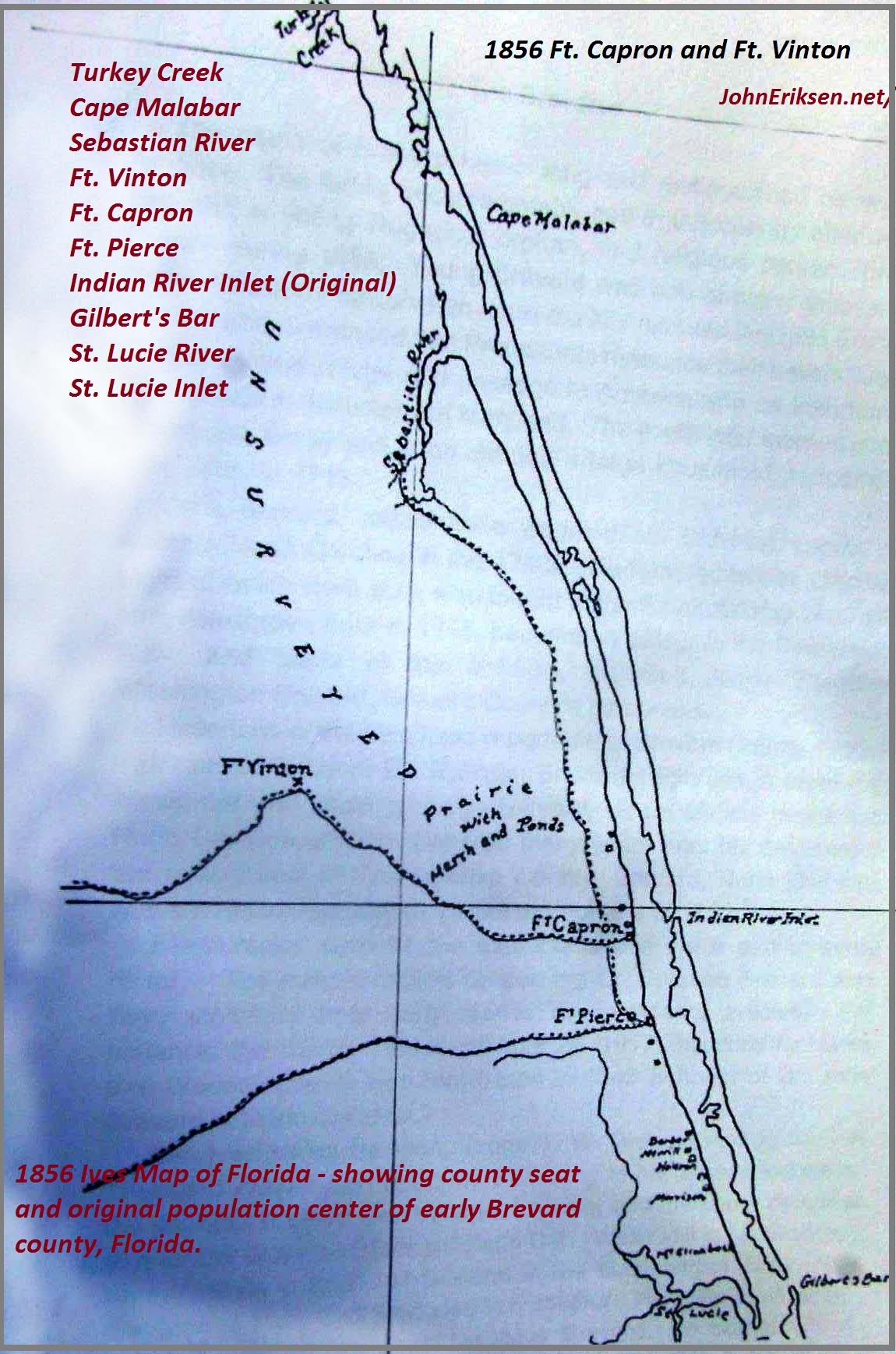
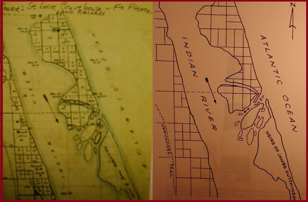 Original Indian River Inlet |
|
 1850s Brevard |
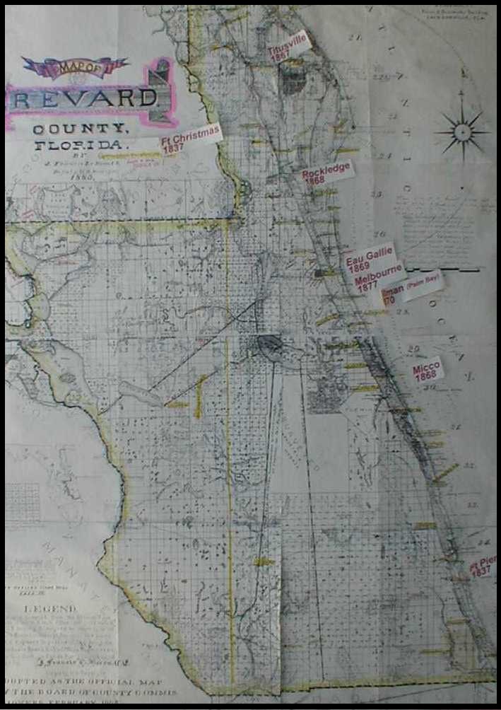
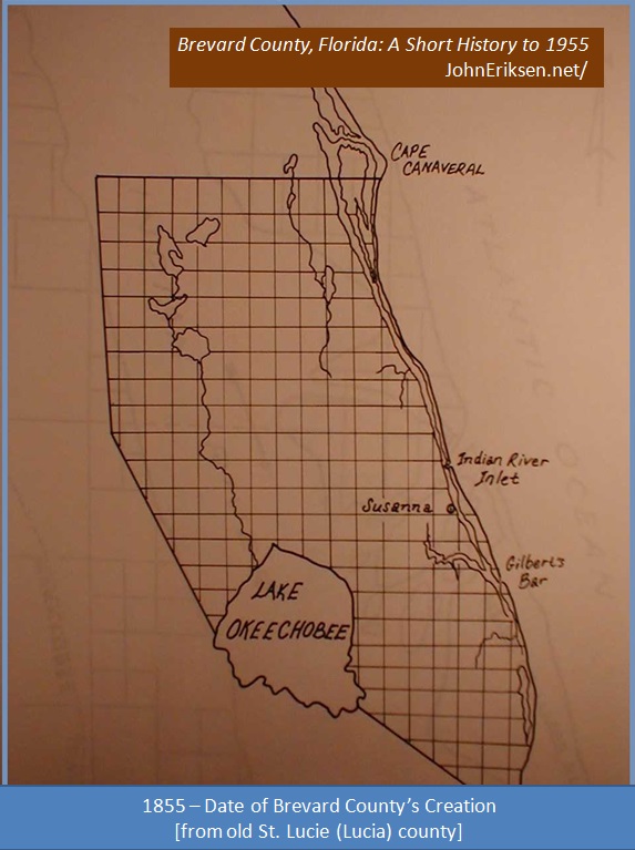 Original Brevard Settlements |
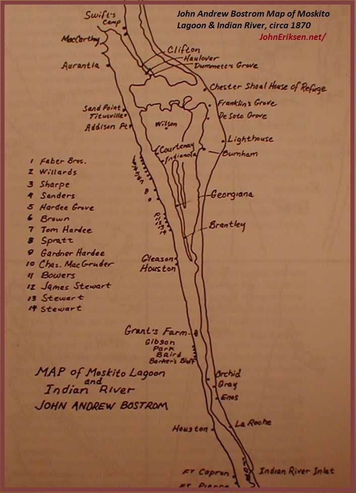 1870s Indian River Settlements |
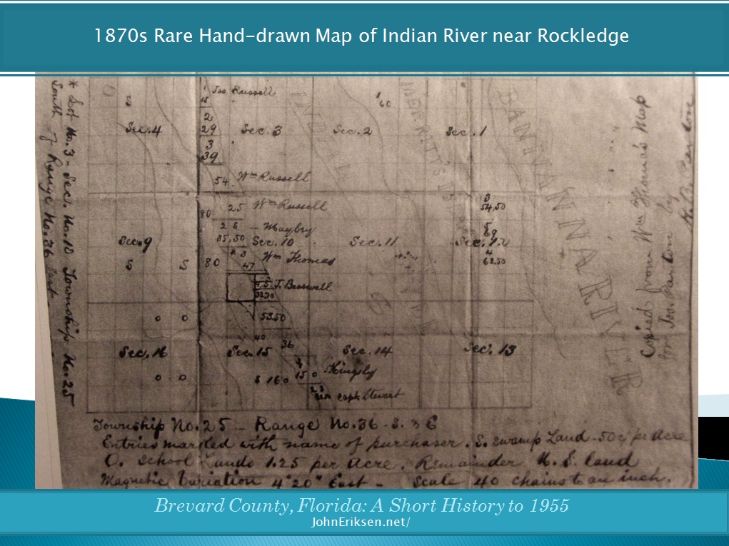 1870s Map of Rockledge & Indian River |
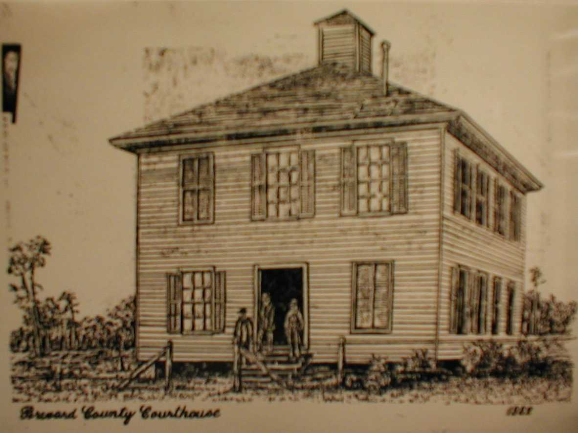 Old Sketch of 1882 Brevard County Courthouse |
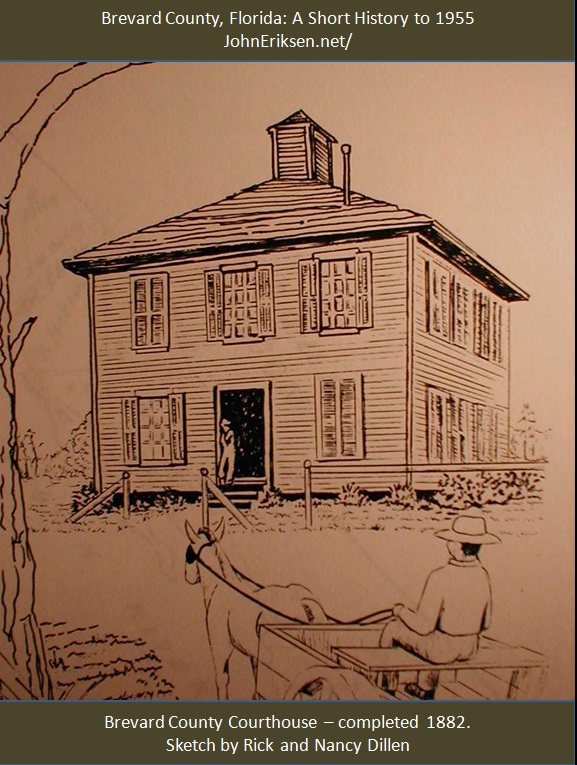 Courthouse Sketch by Rick and Nancy Dillen |
 Gleason's Florida |
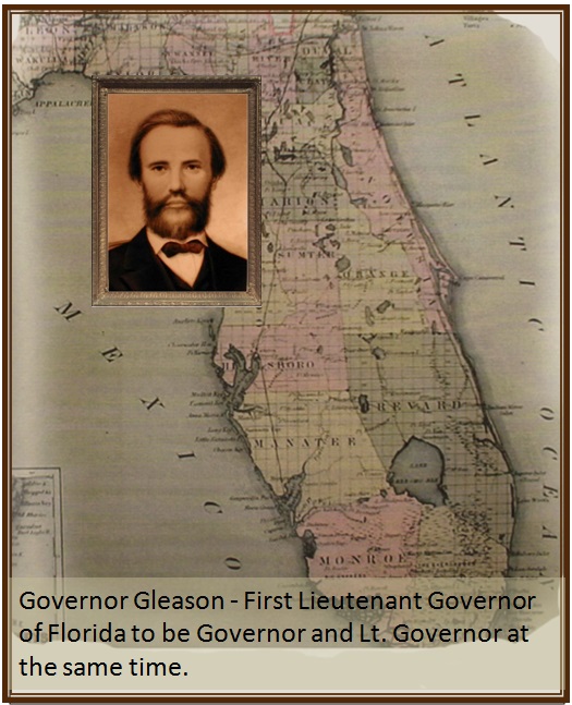
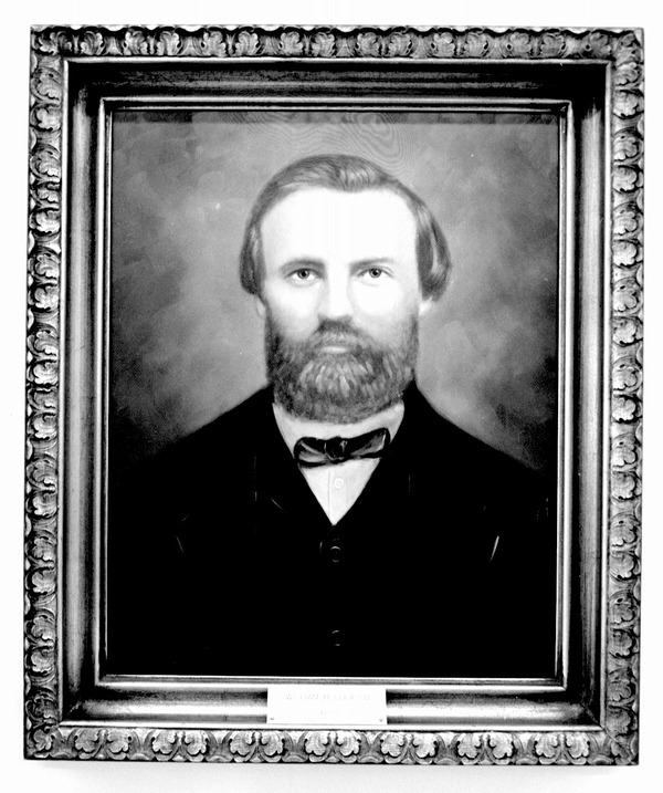 William H. Gleason |
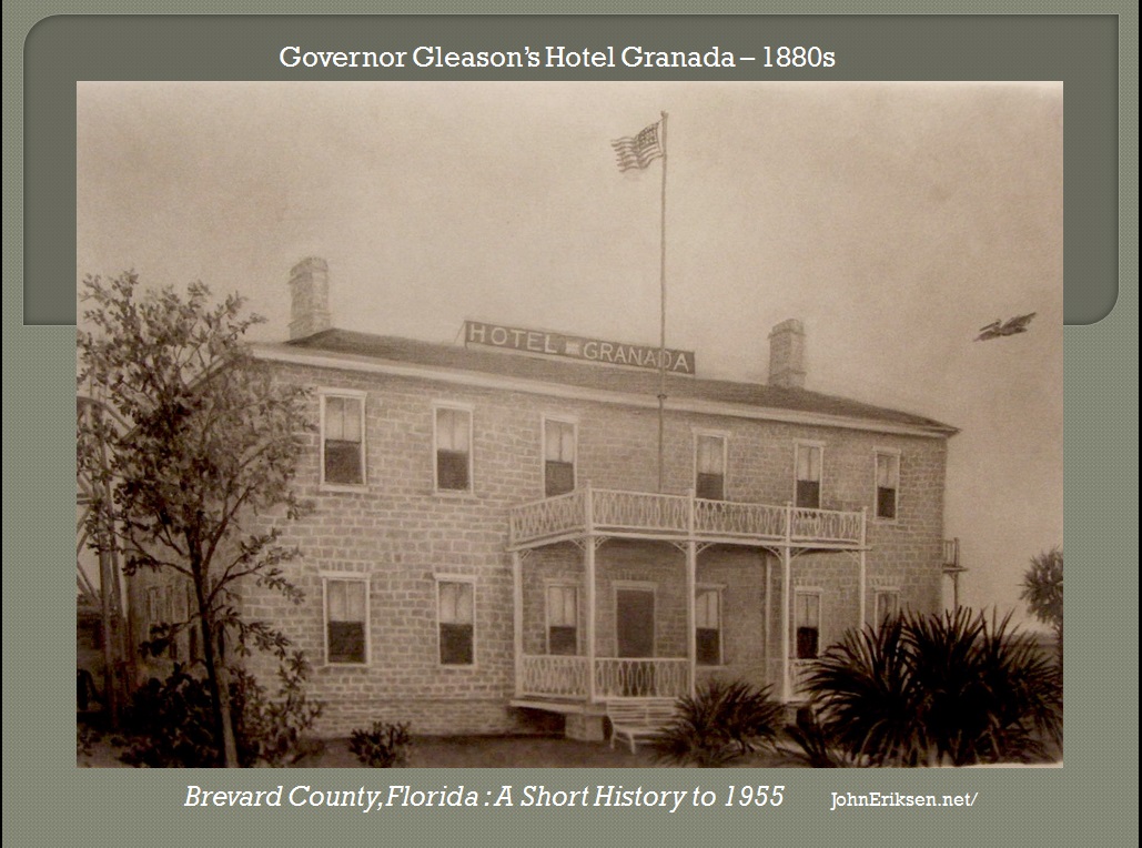 Gleason's Hotel |
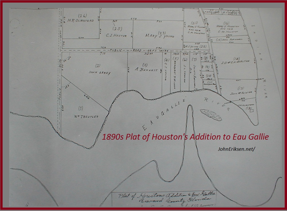
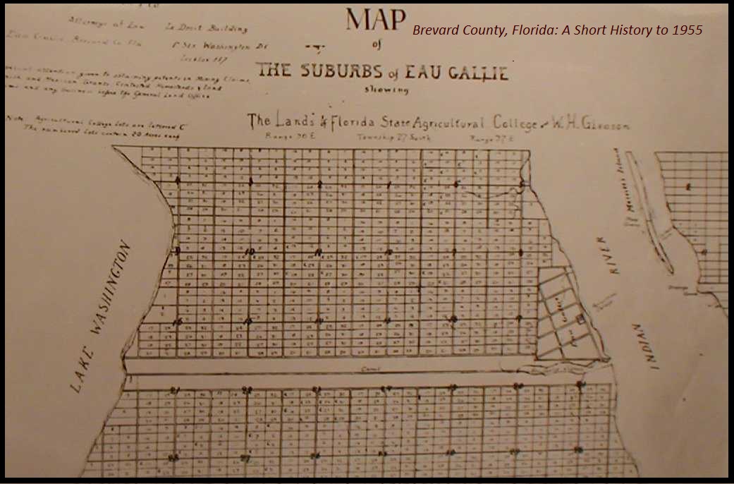 Gleason's Plat of Eau Gallie, Florida |
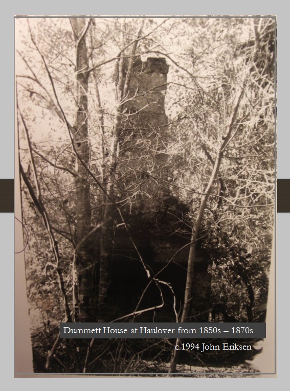 Remnants of Dummett House |
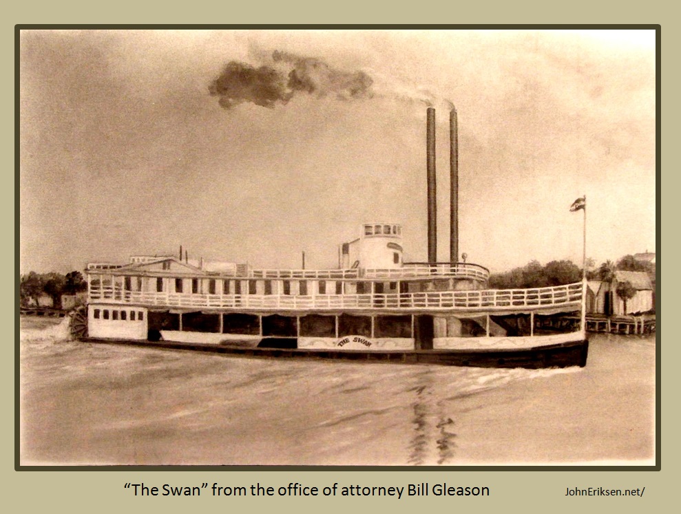 "The Swan" from the office of attorney Bill Gleason |
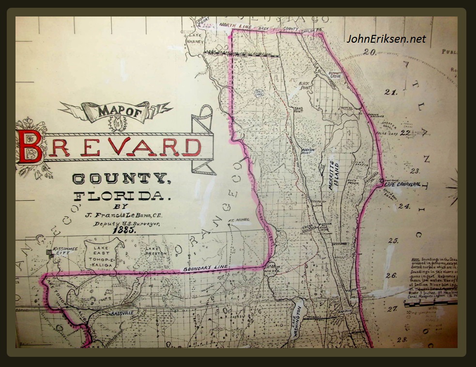 1885 LeBaron Map of Brevard County |
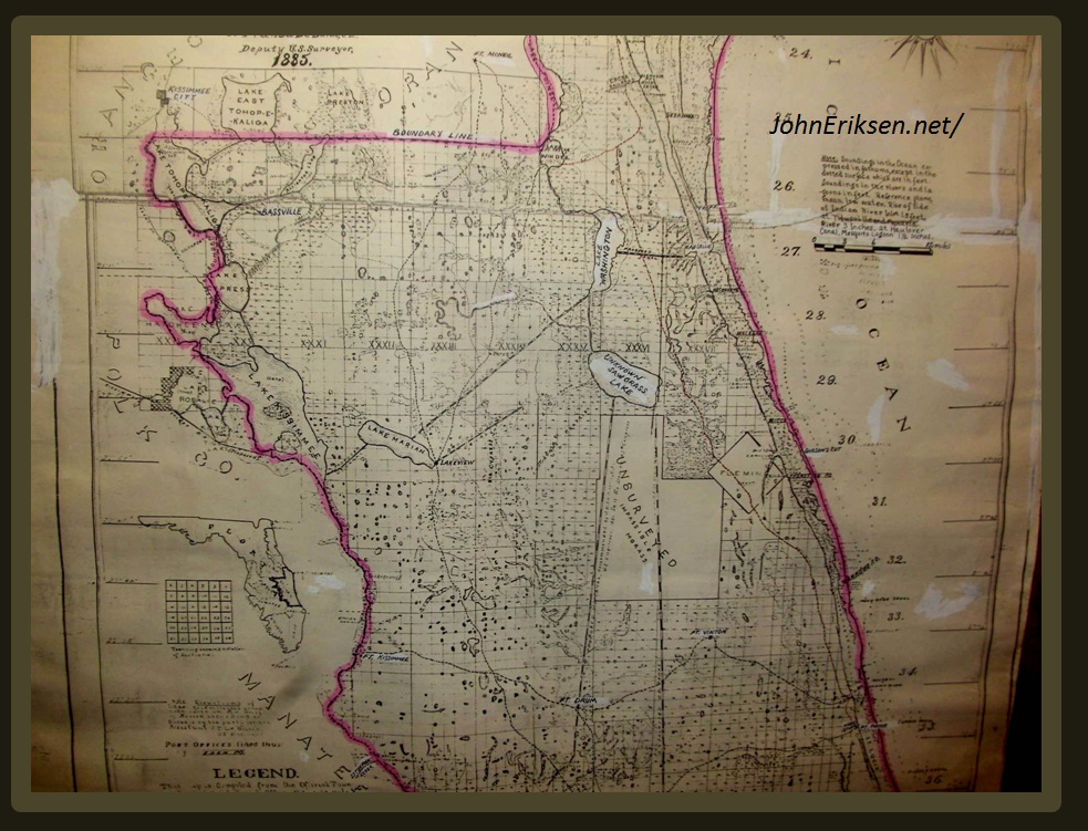 1885 LeBaron Map of Brevard County |
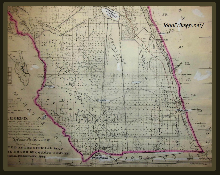 1885 LeBaron Map of Brevard County |
 1885 LeBaron Map of Brevard County |
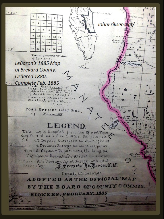 1885 LeBaron Map of Brevard County |
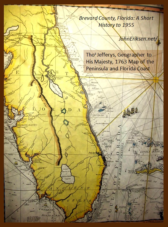 1763 Jefferys Florida Map |
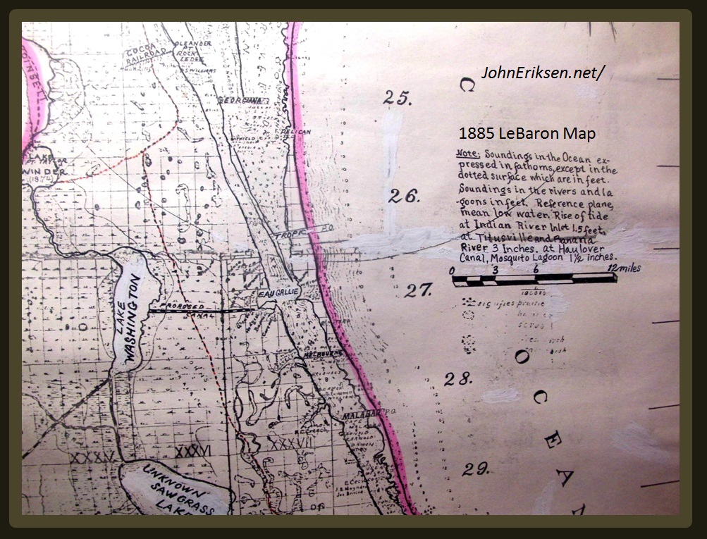
 1885 LeBaron Map Brevard County, FL |
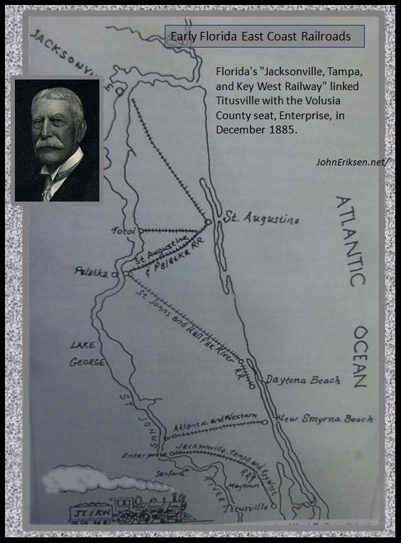 Flagler's Original RRs |
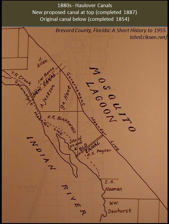 Old Plat of Haulover between Mosquito & Indian River Lagoons |
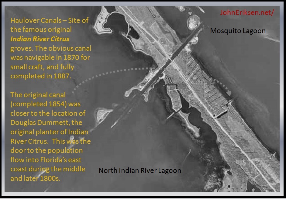 Ariel Photo of Haulover |
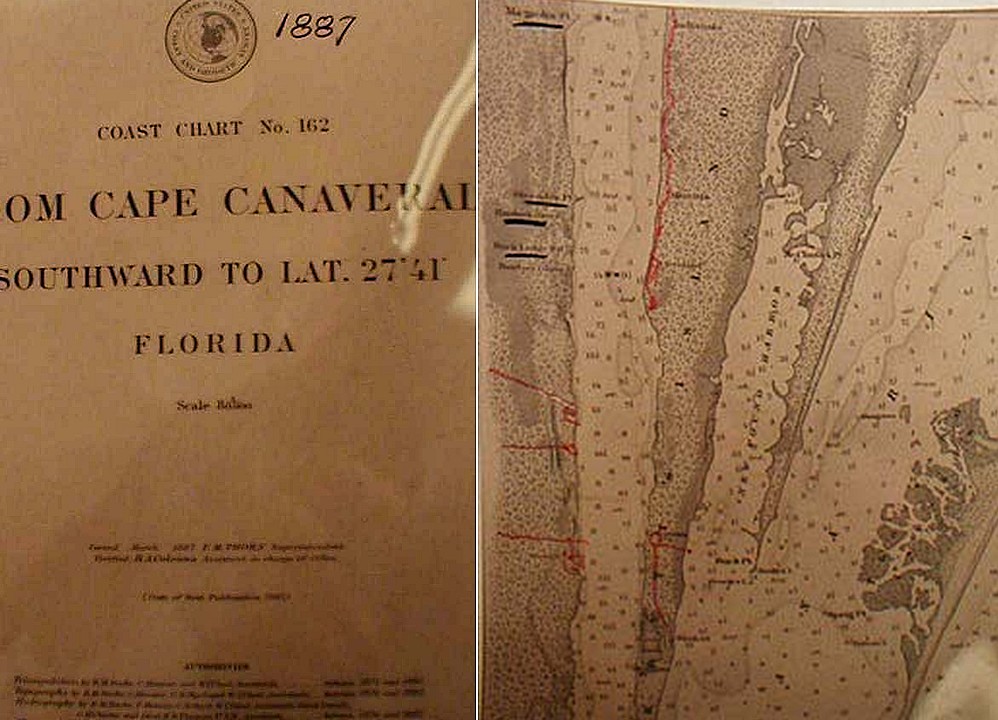 1887 Coast Chart of Indian River |
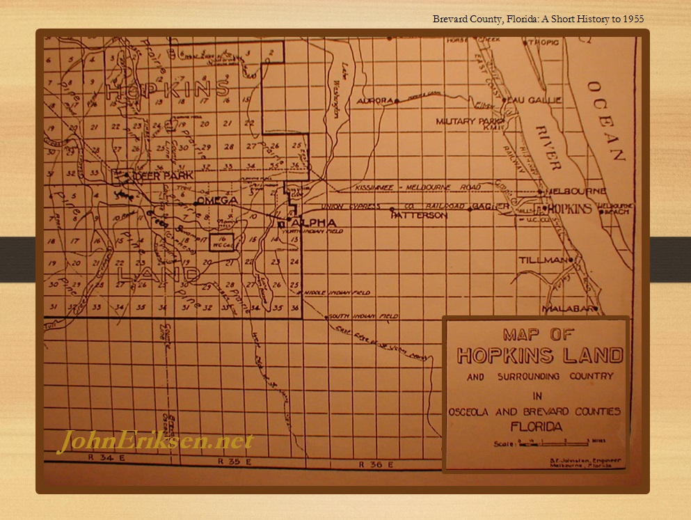 George Hopkins Land |
 Elbow Creek (Eau Gallie River) |
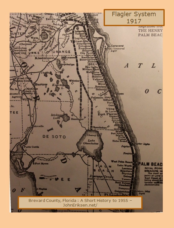 Flagler System |
 Pioneer Communities |
-Hopkins-Pineda-Malabar.jpg) Early1900s Towns |
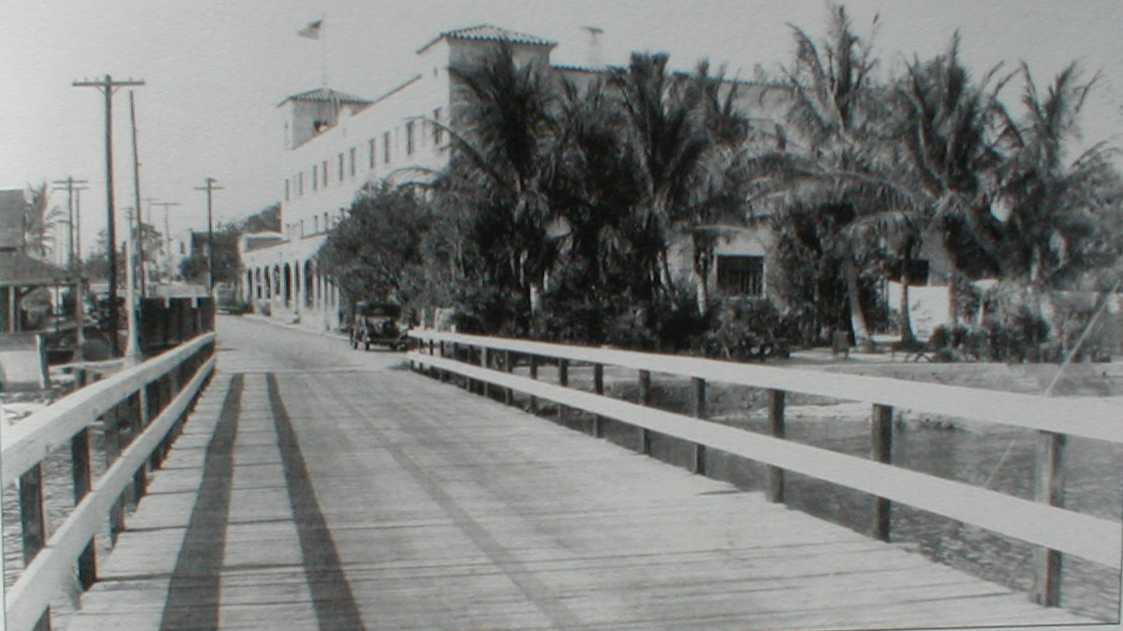 Eau Gallie Bridge (typical of early bridges on Indian River) |
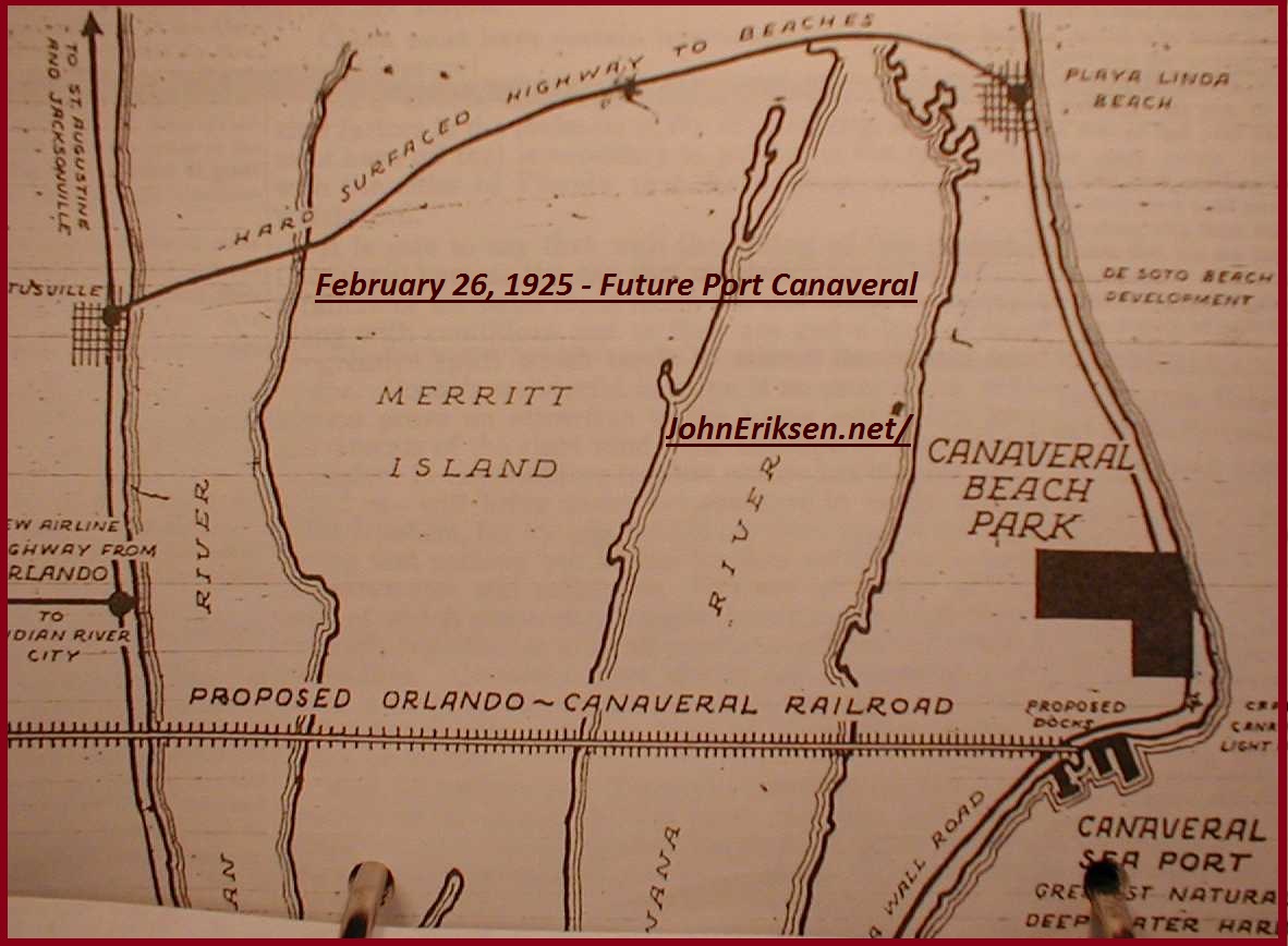 Beginnings of Port Canaveral |
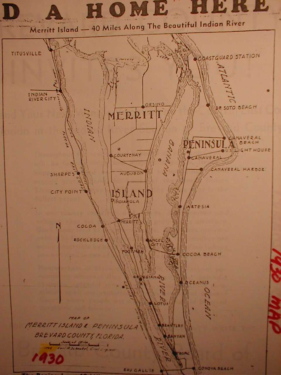 1930s Map |
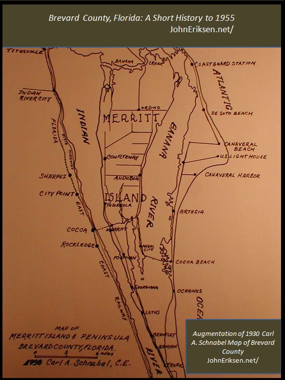 1930s Map |
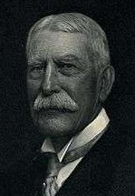 Flagler |
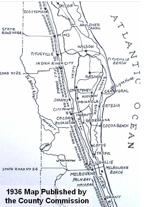 1936 map |
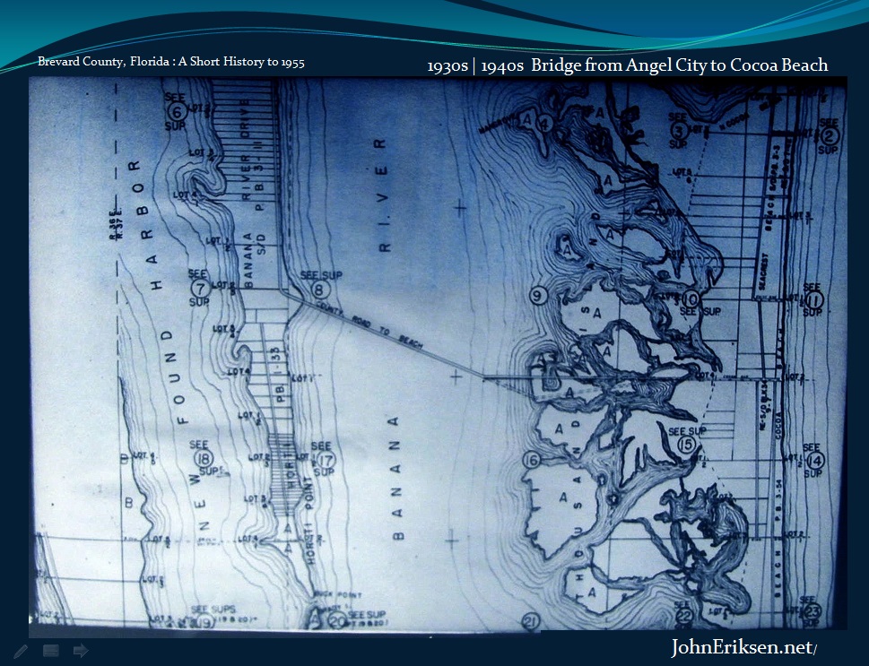 1930s Bridge to Cocoa Beach |
 1940s Map |
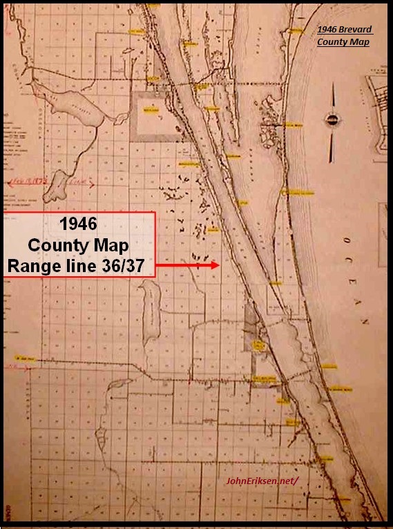 1946 County Road map |
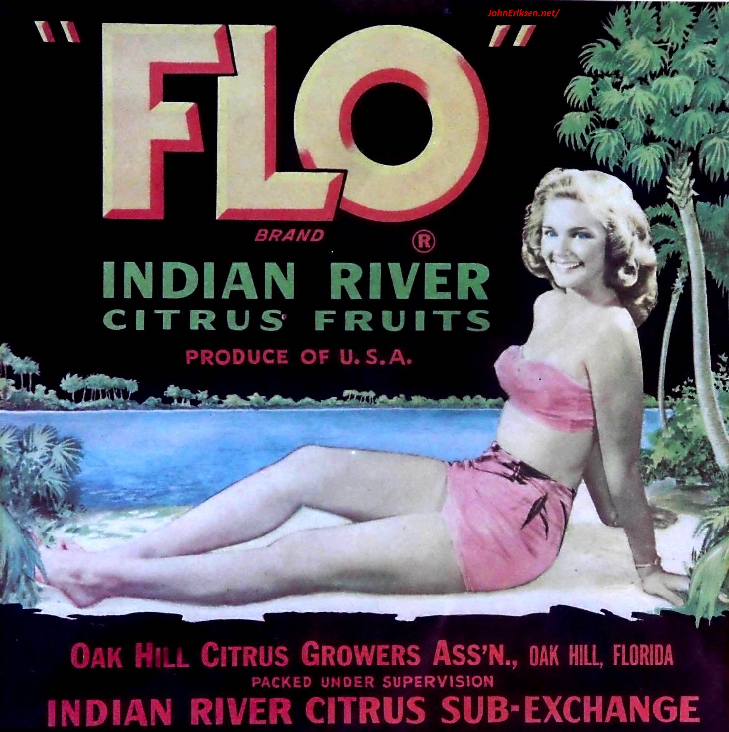 1940s Orange Crate Art of the famous Indian River Citrus |
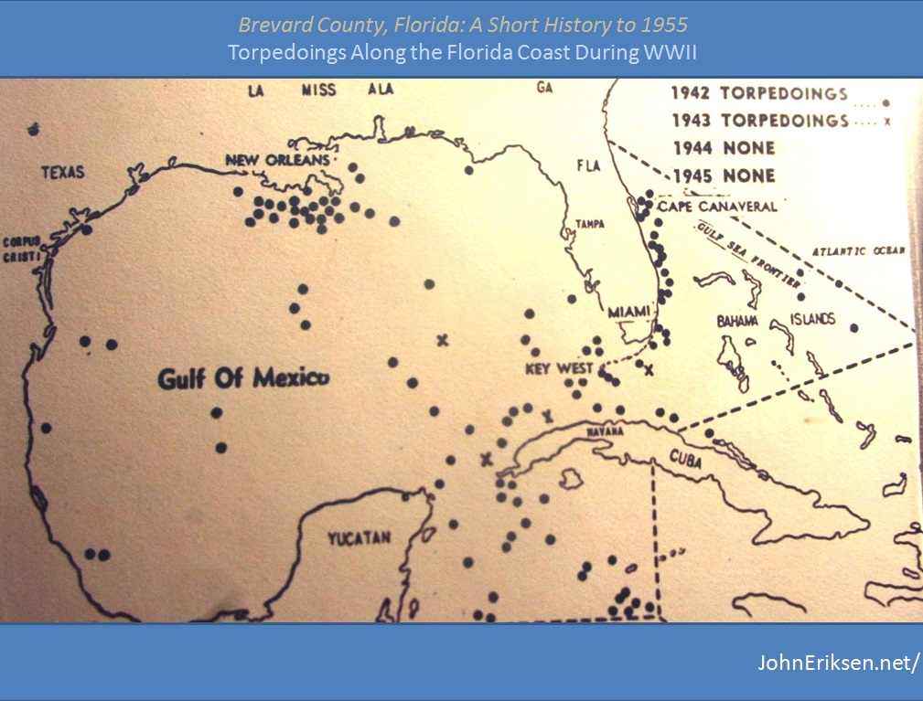 Torpedos of WWII |
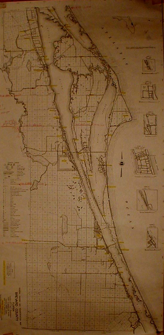
Brevard Co Map |
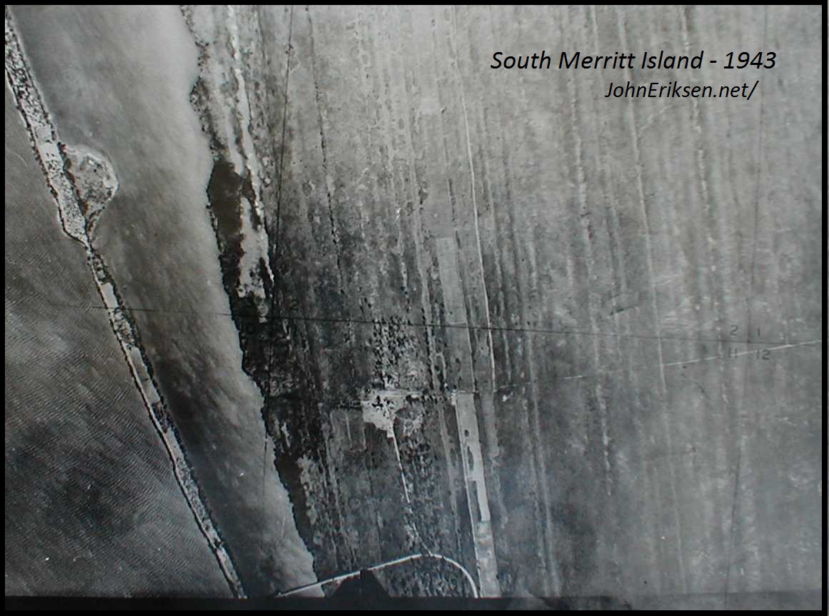 South Merritt Island Typical of WWII Aerial Maps |
 Early 1950s Beach |
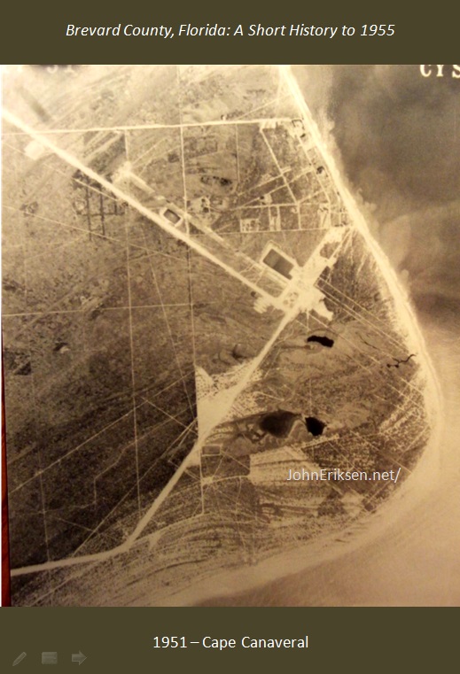 1951 - Aerial of Cape Canaveral |
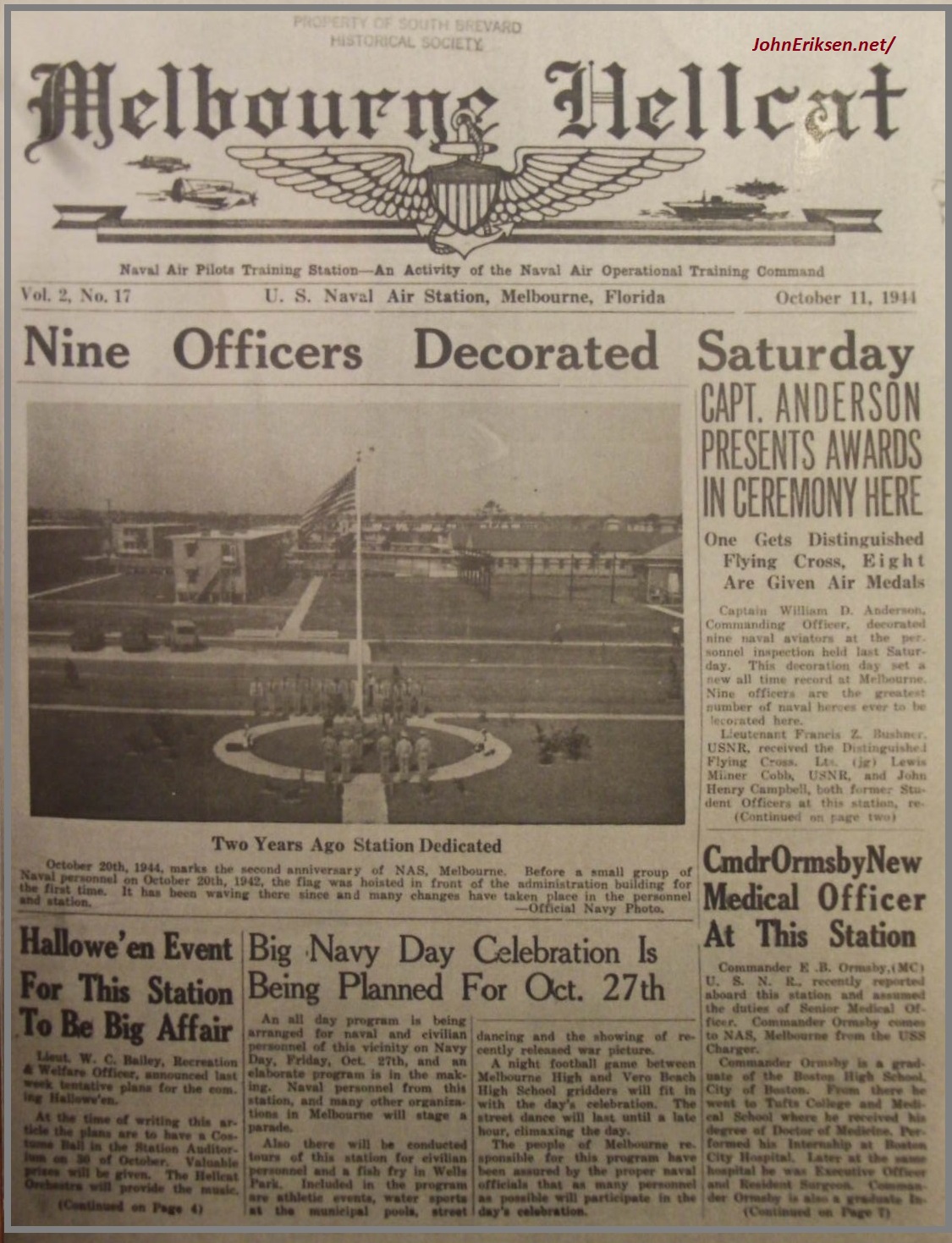 Melbourne Hellcat Paper |
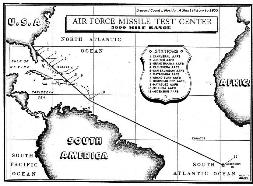 Air Force Missile Test Center Downrange Map |
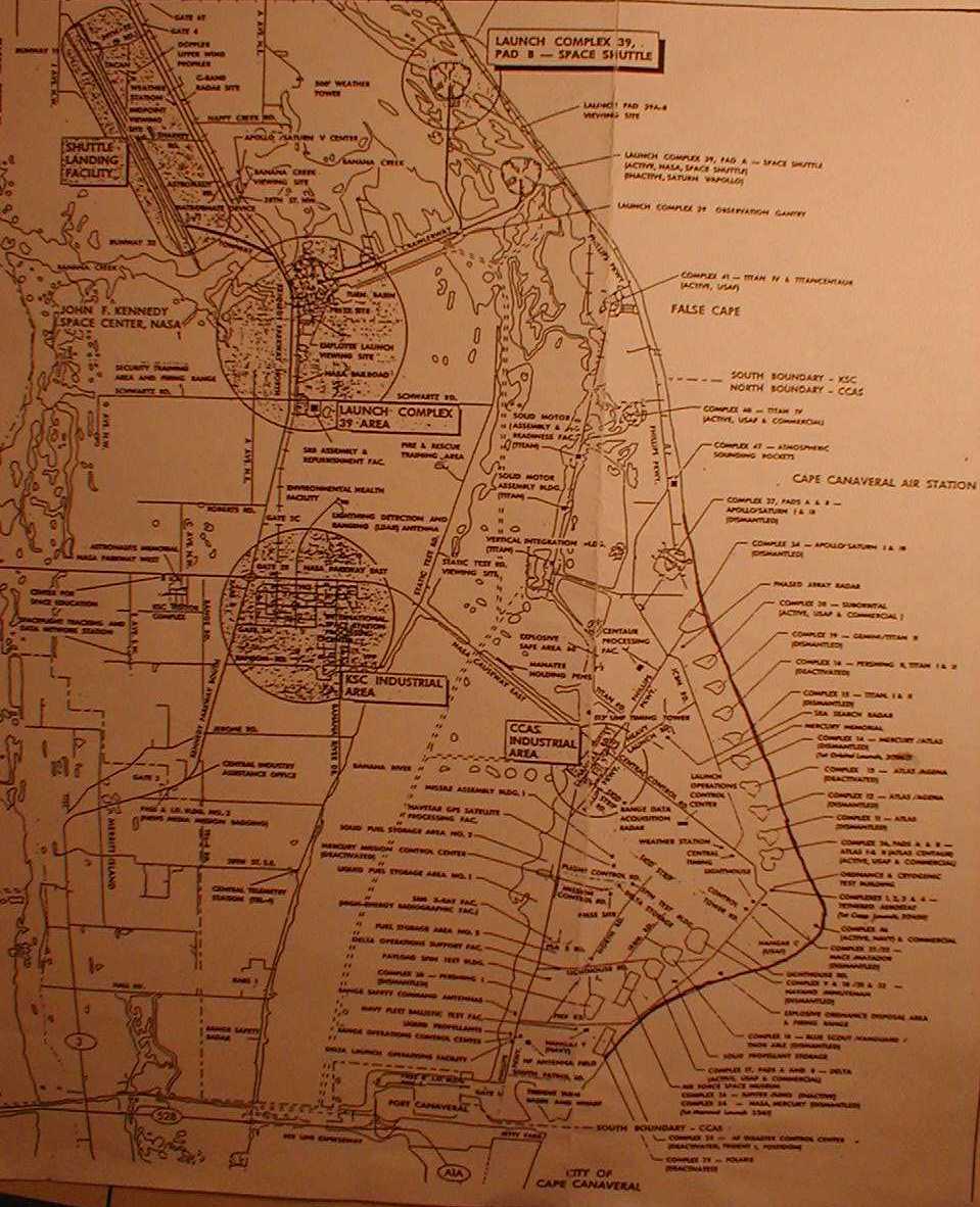 CCAFS Map |
Snark |
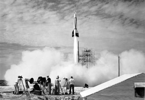 Bumper8 June 24, 1950 |
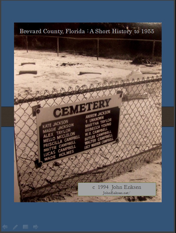 Graves of Canaveral pioneers at CCAFS |
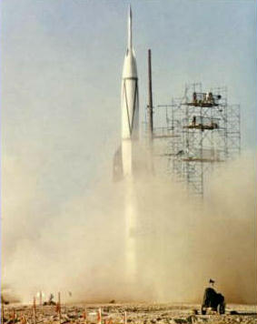 Bumper |
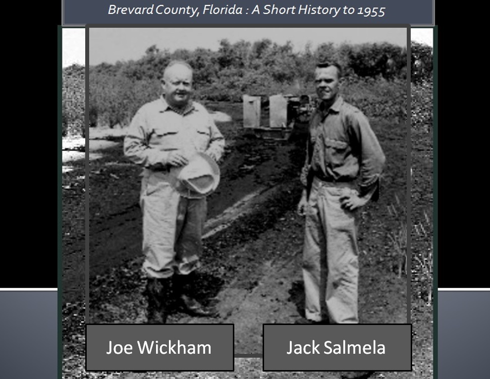 Commissioner Joe Wickham & Jack Salmela |
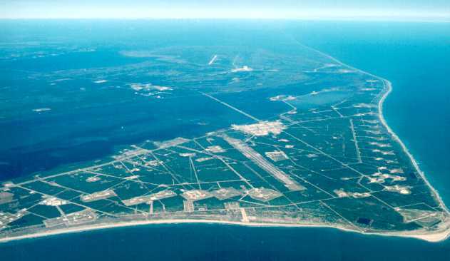 Cape - Aerial View |
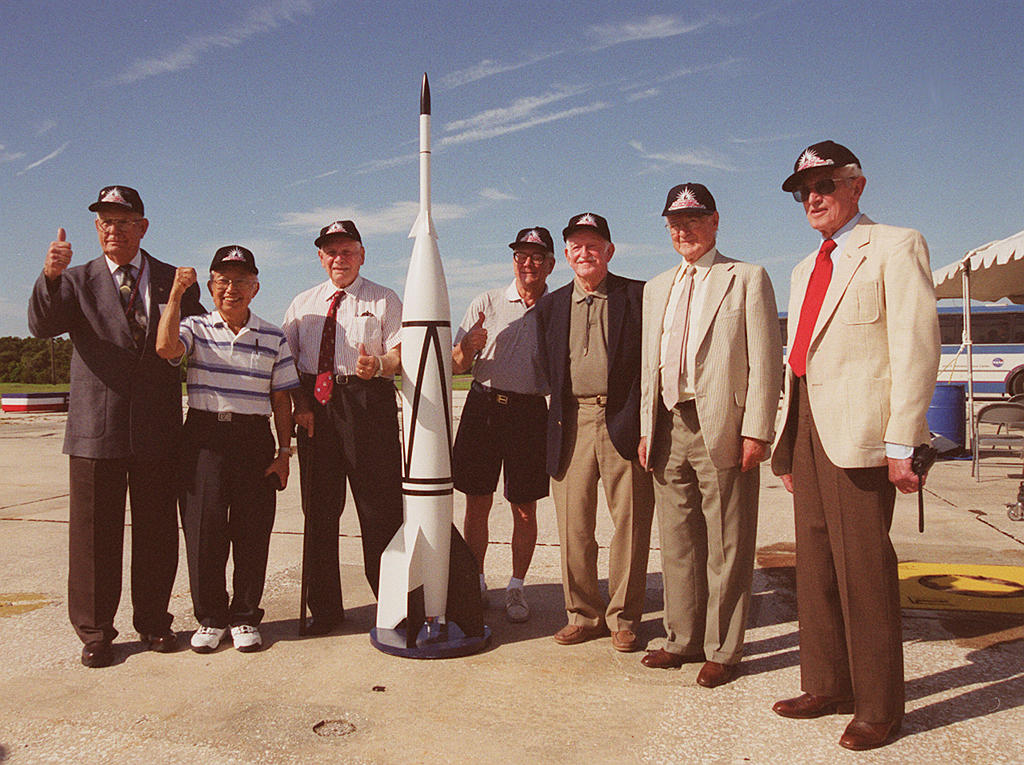 Bumper8 Pioneers |
|
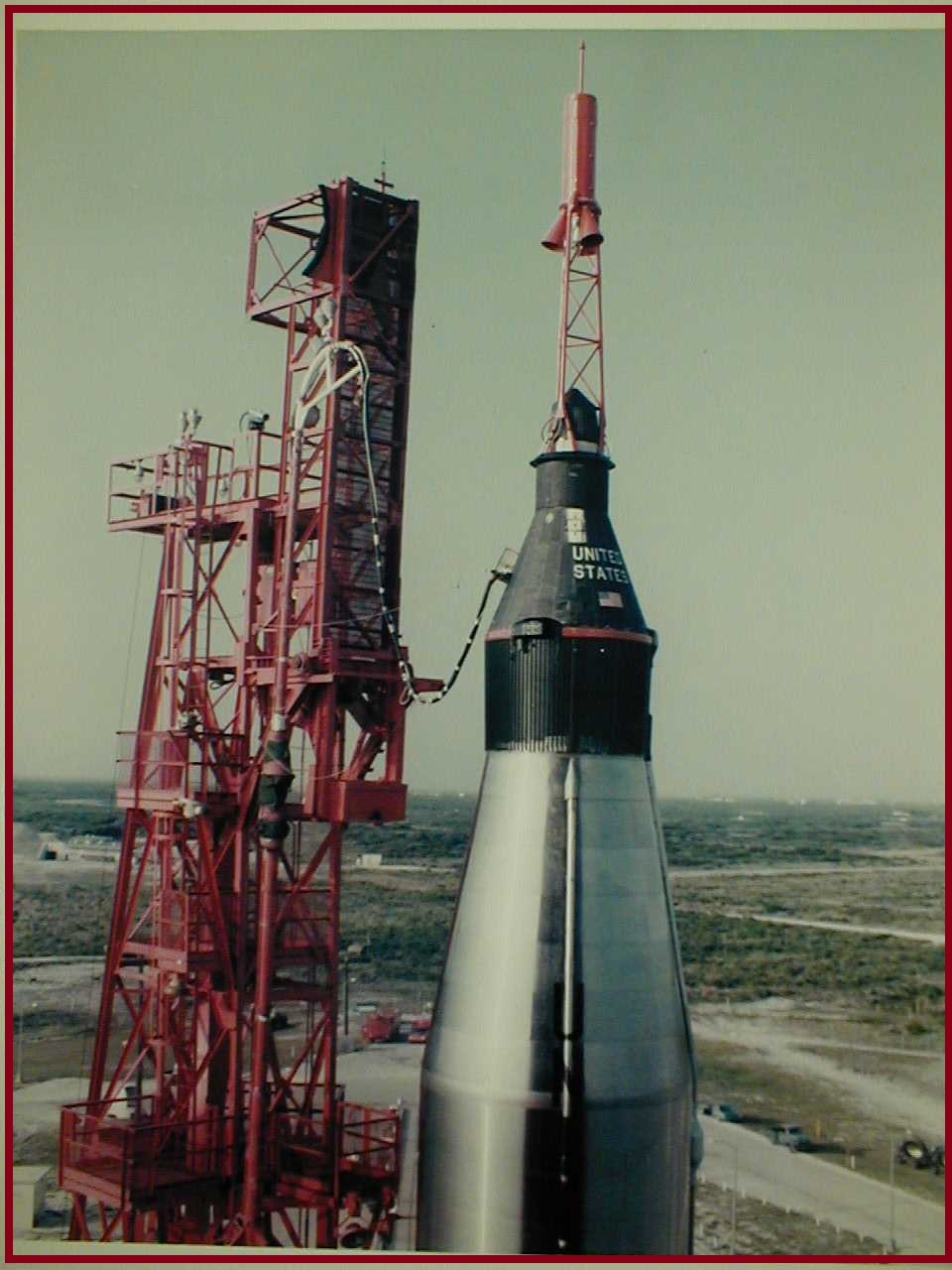 Mercury Capsule |
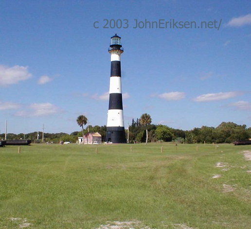 Canaveral Light |
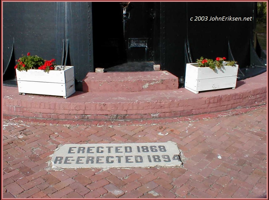 Door to the Canaveral Light |
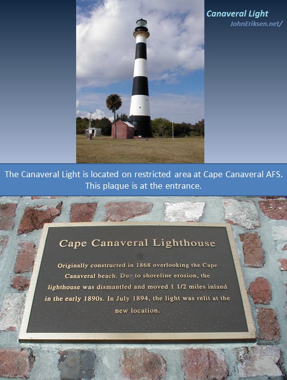 Canaveral Light Plaque |
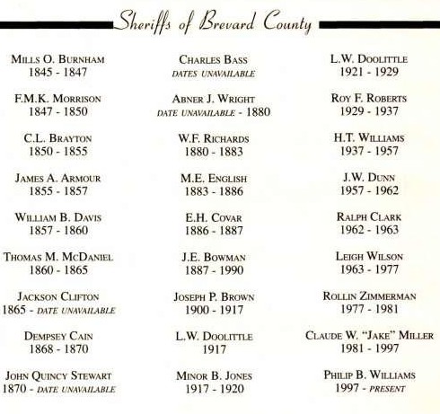 List of Brevard County Sheriffs |
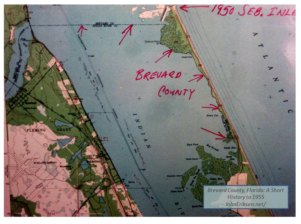 1959 - Last border change - south beaches "given" to Indian River county by Joe Wickham |
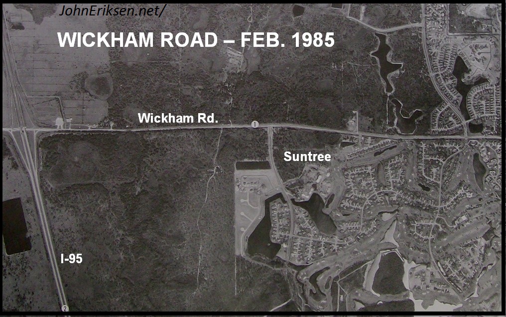 Aerial of Wickham Road in 1985 |
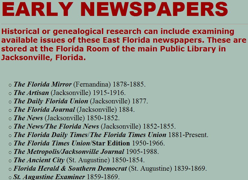 Jacksonville - Early Newspapers |
forthcoming |  |
Brevard County, Florida : A Short History to 1955 (Read Excerpts) |
|
| Brevard County, Florida : A Short History to 1955 (Purchase) |
|||||